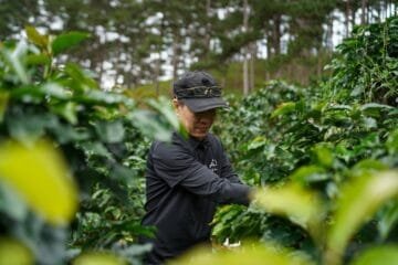
Real talk: A new remote sensing model is rewriting how we track coffee farms in China. Researchers used machine learning and Sentinel-2 satellite data to map Yunnan’s Pu’er region with near-95% accuracy, creating a template that’s lightweight, scalable, and surprisingly precise. This isn’t just about counting trees—it’s about redefining how governments, farmers, and traders monitor sustainability in complex landscapes.
The study, published in Frontiers in Remote Sensing, hinges on tracking seasonal changes in vegetation, terrain, and administrative boundaries to distinguish coffee from tea bushes or shrubs. In controlled tests, the model correctly classified land pixels as coffee or non-coffee 95% of the time. When applied to Pu’er’s entire coffee-growing area, it estimated 53,000 hectares—slightly higher than the official 45,266 hectares. The gap? Likely due to misclassifying spectrally similar plants like tea trees. Yet the final map aligned closely with field data and online checks, proving its reliability.
This isn’t just a technical win. The model’s simplicity is its strength. Unlike bulky land-mapping tools, it requires minimal input and output parameters, making it easy to adapt. Adjust a few key variables, and it could work in other regions with similar agro-ecological conditions. For farmers, this means better resource allocation. For governments, it’s a tool for enforcing sustainability standards. For traders, it’s a way to verify supply chain ethics without boots-on-the-ground audits.
The research team, led by Yunnan Land and Resources Vocational College and the Chinese Academy of Sciences, emphasizes scalability. Their method isn’t just for coffee—it’s a blueprint for monitoring other crops in fragmented landscapes. The implications? A future where satellite data replaces guesswork, turning coffee farming into a data-driven industry.
But how soon before this tech reshapes how we grow, trade, and sustain our favorite brew.
So here’s the takeaway: This model isn’t just mapping coffee—it’s mapping the future of precision agriculture. But how soon before this tech reshapes how we grow, trade, and sustain our favorite brew?
What’s your take? How might this technology change the coffee industry? Share your thoughts below.
Questions & Answers
How accurate is the remote tech mapping China’s coffee lands?
The study claims near-95% accuracy in mapping China’s coffee-growing regions using remote technology.
What technology was used to map China’s coffee lands?
The study used remote sensing and geographic information systems (GIS) to map China’s coffee-growing areas with high precision.
Information sourced from industry reports and news outlets.